Local Green Space for Winnersh
Prue Bray
Liberal Democrat Councillor for Winnersh ward Learn more
Housing for 69 King Street Lane
Land to the rear of the Bulldog Garage
Local Green Space for Winnersh
Housing for 69 King Street Lane
Land to the rear of the Bulldog Garage
A complex post about a complex subject: Matthews Green planning application
by Prue Bray on 28 October, 2014
Last week I went to the combined North and South Wokingham SDL Forum, and heard about the recently submitted outline planning application for 760 (-ish) houses at Matthews Green Farm. Having looked in great detail at it today, I have sent a long (well, very long actually) email to the planning officer asking some questions about the interrelationship between the proposed development and the proposed northern distributor road. I don’t usually blog about the details of what I have asked planning officers, but in this case I am going to, because I know the line of the distributor road and how it is going to affect residents is of huge interest to a lot of people in Wokingham, especially in Emmbrook and Winnersh. Because it is so complex, I am not expecting instant answers.
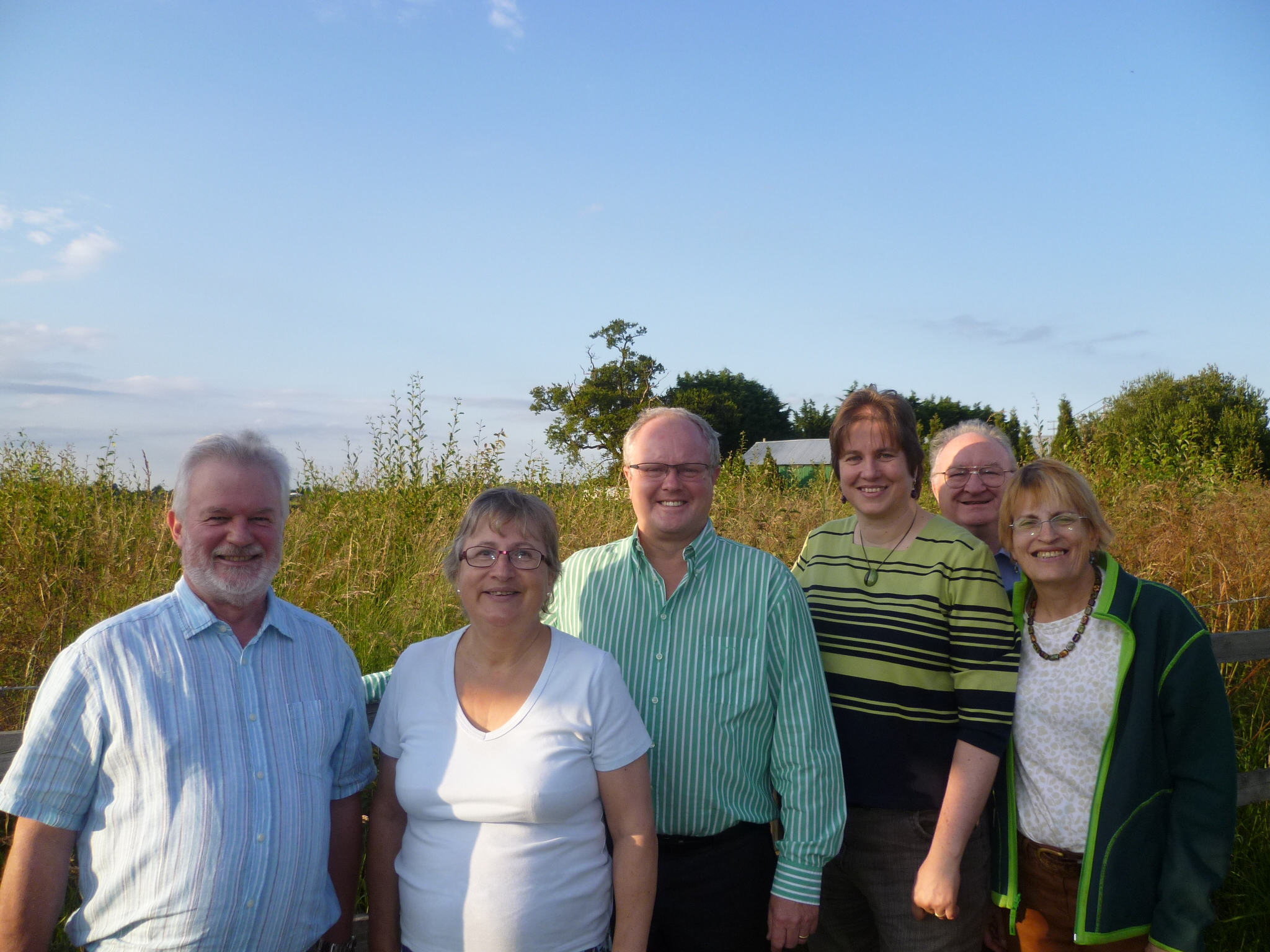 Photo shows me with Lib Dem activists and our prospective parliamentary candidate Clive Jones (centre) by the Matthews Green site
You can see the details of the planning application for yourself by looking up O/2014/2242 at http://www.wokingham.gov.uk/planning/services/search/ Meanwhile, here is what I have asked – with a minor health warning that it’s long and complicated! But if you’ve ever wondered what councillors do, here’s an example of how we spend hours and hours of our time!
1 The roundabout on Twyford Road is fairly straightforward, as it comes at the end of Bell Foundry Lane. I don’t think there are many other options. Could you confirm for me whether there are any alternatives?
2 The Access and Movement Parameter Plan shows a pink route through the site coming out on Toutley Road near Brimblecombe Close, and two orange alternative routes which could lead out to a new road if one was to be built using a route round the back of Toutley. The masterplan assumes the pink route is the one which is going to operate within the site. I fully understand that the masterplan is only illustrative and that the layout is for an RM application. Therefore both orange routes are still technically feasible as the masterplan is only a sketch of what a layout could look like, not what it will look like. So what happens within the site as regards roads is still all up in the air. The fact that no access points are shown on that northern boundary of the site (despite access being included in the outline application) does not prevent a future application including them.
Q 1 Please could you confirm I have understood that correctly?
Q 2 If this did happen, would you envisage a further outline application to deal with accesses before the RM application, or would it more likely be a full application that came forward, to deal with everything at once?
3 The masterplan shows 3 accesses along Matthewsgreen Road, which are not shown on the Access & Movement Parameter Plan, but do appear in the Design & Access Statement (e.g. 4.5 Transport Diagram). The accesses are to be determined at outline. Because the masterplan is only illustrative, it is not clear exactly what those 3 accesses will be used to access. I can only assess intention by what is in the masterplan. That indicates that the middle access point on Matthewsgreen Road will only be used for a smallish cul-de-sac. If that is what is intended, then I would see that as unproblematic. The accesses to either side of it are shown as providing routes through the site. You could see that as providing permeability and convenience, or you could see it as providing options for ratrunning through residential roads to shortcircuit the distributor road main accesses. The Design & Access Statement section 6.1 mentions 6 accesses in total (2 x Toutley Road, 1 x Twyford Road, 3 x Matthewsgreen Road makes 6, although they are not enumerated in the D&A statement). Of the accesses on Matthewsgreen Road it says only:
Points of access onto the southern end of Toutley Road and Matthewsgreen Road would be provided to serve small segments of the development. That suggests they are not supposed to be through routes, which seems to conflict with the masterplan and with what appears later on under Internal Road Layout, where the Design & Access statement says As indicated on the indicative Masterplan, it is proposed that the internal road network would be designed in such a way as to minimise rat-running through the site to and from Matthewsgreen Road. A number of design features could be implemented to prevent this, details of which will be included at the Reserved Matters stage.
Q 3 Could you confirm whether the intention is to provide through routes using these accesses off Matthewsgreen Road?
Q 4 Can you tell me how the feasibility work on the distributor road is taking into account traffic movements onto and off the road from or to Matthewsgreen Road, including whether some traffic that would currently come out along Holt Lane or by the Rifle Volunteer might choose to go via the distributor road?
4 There are 2 access points shown on Toutley Road. The more southerly is shown with a green arrow on the Access and Movememt Parameter Plan, and only links to a small cul de sac according to the masterplan.
Q 5 As the masterplan is only illustrative, can you confirm that there is no intention to include a second access point to the distributor road/main route through the site at this point?
5 The red line for the application site includes a section of Toutley Road. On the Access & Movement Parameter Plan, there is a green arrow at the southern end of this section of Toutley Road, and there is a brown arrow at the northern end. The alignment of Toutley Road is to be altered to accommodate retention of a TPO tree (T9). Drawing number 4676.015 “Proposed diversion of Toutley Road” (labelled in the documents list on the website as Proposed NWDR Route onto Toutley Road) shows this realignment. Brimblecombe Close will have to be extended slightly to reach the newly aligned road, but otherwise the intention appears to be to use the existing Toutley Road as the distributor road – and as an exit for traffic from the site. Drawing 4676.015 seems to suggest that Toutley Road will have a T junction with the line of the distributor road, i.e. that there will be a stop or give way line on Toutley Road at the junction with the distributor road, while the way the masterplan has been drawn suggests that Toutley Road is the more major road. My understanding is that the line of the distributor road is intended to be the primary route.
Q 6 Could you confirm what the respective roles are of the new route through the site and of Toutley Road between Emmbrook Road and the new distributor road?
Q 7 If the council after feasibility work opts for an alternative route for the distributor road, will the proposed design for this Toutley Road/site access point still be appropriate?
Q 8 Will it still be appropriate to have a major exit from the site onto the continuation of the existing Toutley Road towards Old Forest Road (i.e. from the brown arrow onwards)?
6 That brings me to my final point, the one I was trying to make at the SDL forum last week. Surely the design of what happens where Toutley Road meets the edge of the development site is dependent on whether Toutley Road is to form part of the route of the distributor road or not? The council will not report on the feasibility for Option B (sending the road down a different route) until the Spring.
Q 9 How is it possible to approve the form the access will take (and thus determine the planning application) unless the whole route of the distributor is known?
Q 10 If the junction with Toutley Road will remain the same whatever happens – even if traffic calming is deployed within the site along the line of what is no longer a primary route – then surely traffic would continue to use Toutley Road / Old Forest Road rather than any new distributor road, simply because Toutley Road/Old Forest Road would be a lot shorter for some journeys? Wouldn’t that defeat the object of the other route?
Q 11 I feel I still need an answer to the question I asked at the forum. How can this planning application can be determined before the route of the distributor road has been agreed?
1 Comment
[…] until the spring? More on this subject later….but right now I’d say take a look at what Prue Bray has written on […]